yahoo Press
Hurricane Genevieve grows to Category 4, could bring impacts to California
Images
1 / 10
2 / 10

3 / 10

4 / 10
5 / 10
6 / 10
7 / 10
8 / 10

9 / 10

10 / 10
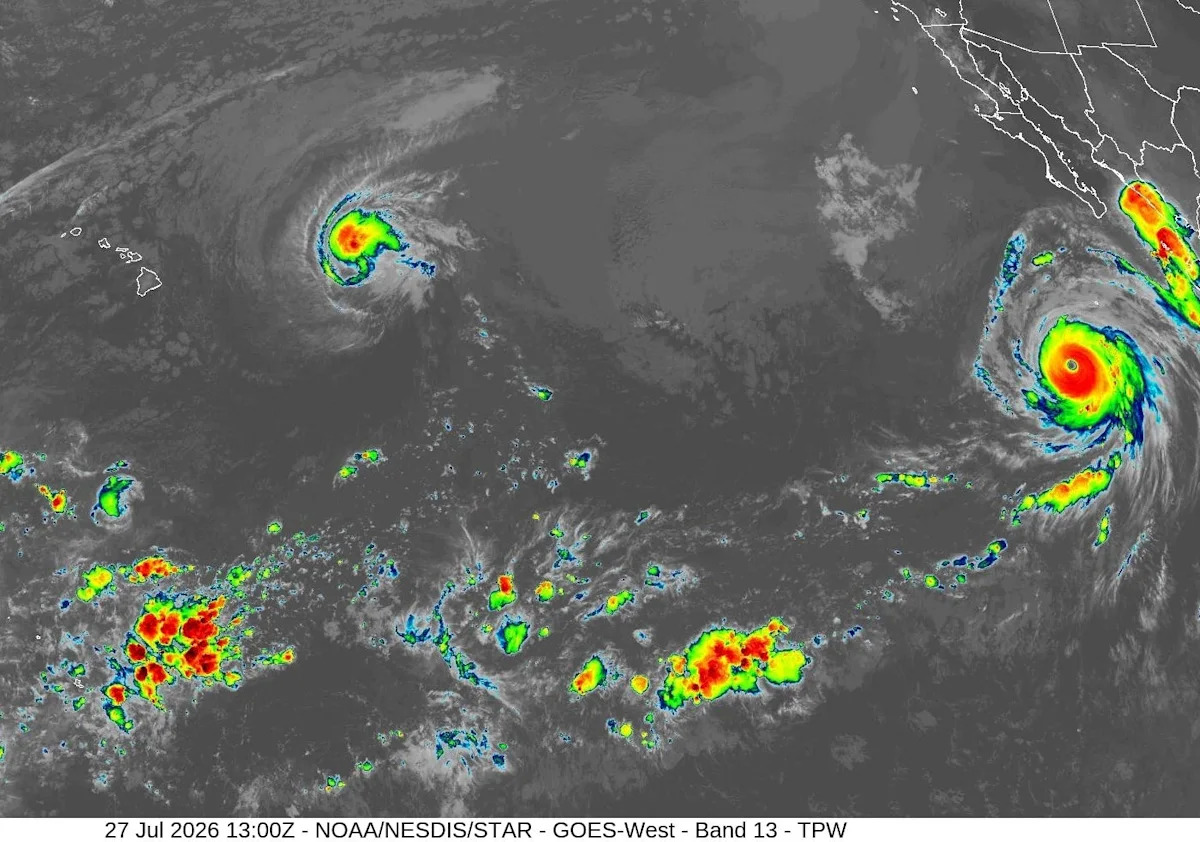
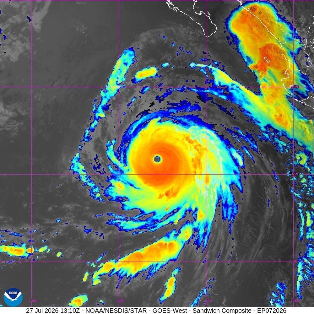
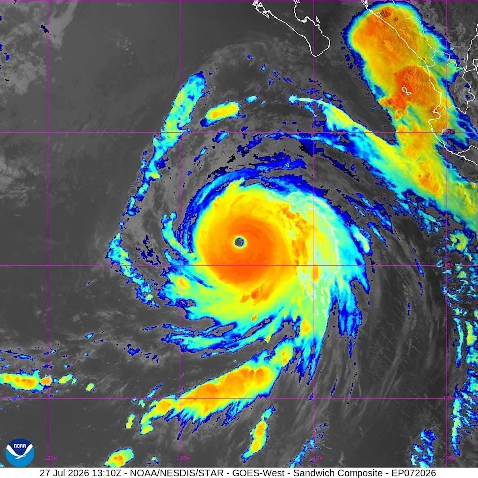
Hurricane Genevieve became a powerful Category 5 in the eastern Pacific Ocean, with sustained winds at its center reaching 160 mph over the weekend, the National Hurricane Center reported.

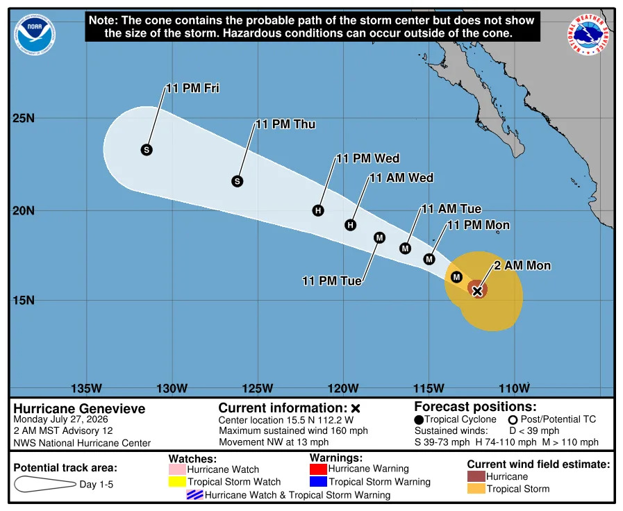
The first Category 5 hurricane in the basin since Kristy in 2024, Genevieve is forecast to bring big waves and possibly coastal flooding to the Southern California coast, the hurricane center said. By Monday, July 27, at 12 p.m. ET, Genevieve's winds had dropped back to 155 mph, a Category 4 hurricane, and its winds were expected to continue fluctuating.

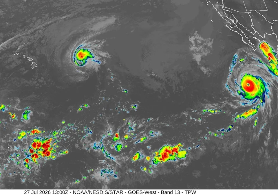
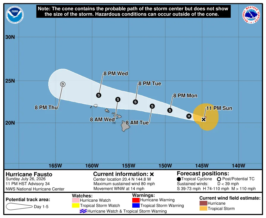
Farther to the west, westward-moving Hurricane Fausto is weakening but is forecast to create stormy seas along the east-facing shores of the Hawaiian Islands as it moves westward north of the islands later this week.

Meanwhile, the Atlantic hurricane basin has no systems expected to develop into storms over the next five days, according to the hurricane center.

Hurricane Fausto, about 670 miles east of Hilo, Hawaii on the morning of July 27, had seen its maximum sustained winds decline to 80 mph, just above the 74 mph threshold for a hurricane. The storm was moving west-northwestward at 14 mph.

Fausto is expected to be downgraded to a tropical storm later on July 27. No tropical storm force warnings are in effect for the islands.

High surf advisories are in effect for east-facing beaches along the islands, as surf generated by the storm is forecast to build westward through July 28 as the storm approaches, the hurricane center said. "Large surf and strong currents will lead to dangerous conditions along exposed shores," the center advised.

The surf is forecast to build to 10 to 14 feet, and the surf advisory is forecast to remain in place until July 29. The hurricane center advised strong breaking waves and currents will make swimming dangerous.

Taking advantage of the warmer than normal waters in the eastern Pacific Ocean, Hurricane Genevieve transformed itself over the weekend. The hurricane experienced a period of rapid intensification that saw its maximum sustained winds nearly double in 24 hours from July 25 to July 26, from 80 mph winds to 155 mph.

Beach advisories already are in place along the southern California coast because of a long-period southwesterly swell, and those seas are expected to build under the influence of Hurricane Genevieve, according to the National Weather Service office in San Diego.

"Some uncertainty exists" in how strong the swells could be, depending on Genevieve's track and strength, but the latest weather service discussion advised the swell could be around 5 to 7 feet, generating breaking waves of 9 to 11 feet at south-southwestern facing beaches on Thursday, July 30.

The swells, in combination with lunar high tides, are likely to result in "at least minor tidal overflow during the evening high tides" this week along the southern California coast. More notable flooding is possible when Genevieve's swells arrive. Thanks to the El Niño conditions, the weather service said tides already have been consistently running up to six inches above predictions.

NOAA's hurricane forecast includes El Niño and a surprising twist

Swells from Genevieve already are affecting portions of the southwest coast of Mexico and southern portions of the Baja California peninsula. The conditions are forecast to spread north along Baja California, causing life-threatening surf and rip current conditions.

Genevieve is forecast to be a short-lived storm, disintegrating into a tropical storm by July 30.

Dinah Voyles Pulver, a national correspondent for USA TODAY, covers climate change, violent weather, the environment and other news. Reach her at dpulver@usatoday.com or @dinahvp on Bluesky or X or dinahvp.77 on Signal.

This article originally appeared on USA TODAY: Hurricane Genevieve grows to Category 4, could bring impacts to California